Elevation: 615m
Parking: 46.4565°, 13.4693°
Ferrata: 46.4427°, 13.4358°


Characteristics
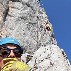
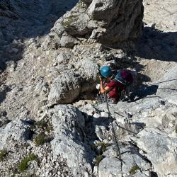
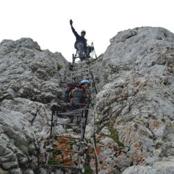
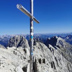
The ferrata Via Amalia is a challenging and very long via ferrata that can be easily compared with the Via Italiana to Mangart and Via della Vita to Vevnica. These via ferratas are without a doubt the most demanding protected climbing routes in the Julian Alps.
Arrival
From Kranjska Gora, cross the Rateče border crossing to Tarvisio in Italy. Continue along the old road to Udine. After a few kilometers from Tarvisio, the road to Ovčja vas / Valbruna turns left. Turn left here and follow the road all the way to Saisera (planina Zajzera) where we park in a large parking lot.
Approach
From the parking lot, we turn onto the road that is closed to traffic behind the Bivacco Mazzeni, Bivacco Stuparich signs. The road descends slightly at first and then leads us through the forest. Soon we come from a forest to a wide stream where there is a lot of sand. Here the path is slightly less visible, and the terrain with sand is cut slightly to the right. The path then leads us to a crossroads where we turn right behind the Bivacco Stuparich signs. With the help of a few rock signs, we cross the torrent again to the right and then the path leads us into the forest. The path through the forest soon begins to climb quite steeply, then turns to the left, and soon we have a beautiful view of the walls of Montasio. The path then leads us along the river bed past some shrubs and bushes and leads us to the crossroads. We continue to the left behind the Stuparich signposts, to the right leading the way to the Grego hut.
The path here turns to the left and begins in the keys to climb through the sparse forest on the left side of the valley. Such a path brings us to a crossroads again. We turn left towards the Stuparich bivouac and the right leads to the Dunja valley. Then the path begins to cross the slope to the east and then soon leads us to the bivouac Stuparich.
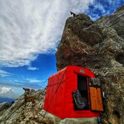
From the bivouac we return a few meters back where the sign on a large rock directs us right up (southwest). The path left down (southeast) leads to the bivouac Mazzeni.
For a short time we climb a slightly overgrown path through the bushes, and then the path leads us to a dry torrent. Here, we turn left and climb up the right side of the torrent bed. There is little markup here, and many rocky signs help us. The trail then turns to the right and crosses the slopes below Montaž towards the west until you enter the climbing part of the trail.
Exit
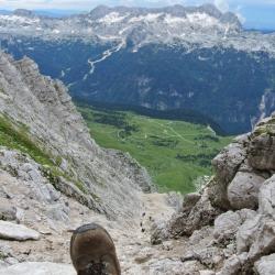
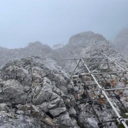
We can descend in the direction of the ascent. However, since this is a long and extremely demanding route, it is advisable to arrange transportation from Pecol , and thus descend the usual southern route over the Pipan Ladder.
Interesting facts
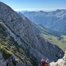
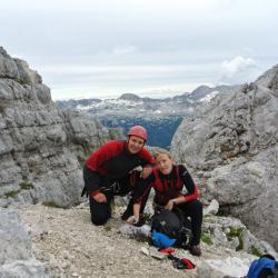
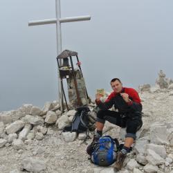
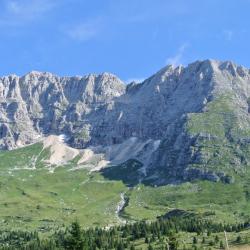
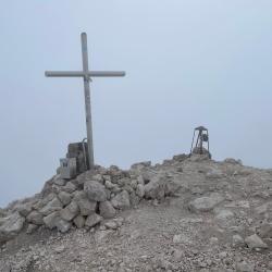
Montasio, 2753 m is the highest peak of the Western Julian Alps and after Triglav (2864 m) the second highest peak of the entire Julian Alps. In terms of size, it would be hard to find a comparable mountain in the Julian Alps - it is majestic!
(Multiple authors)


 © 2026 Ferrata Guide