Good condition
Elevation: 0m
Parking: 49.056°, 14.4429°
Ferrata: 49.0967°, 14.4641°


Characteristics
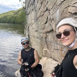
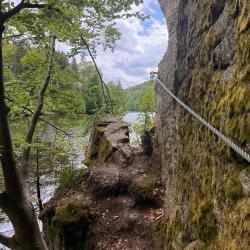
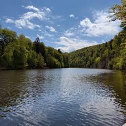
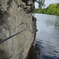
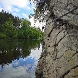
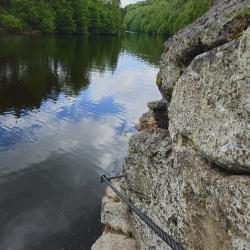
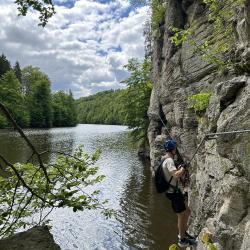
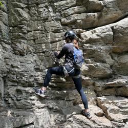
Head to the picturesque Vltava valley between Hluboká nad Vltavou and Purkarec. At a place called Karvanice, on the left bank of the river, steep rock walls rise directly from the water, along which a secured path for safe climbing winds, the so-called via ferrata. Part B is 400m, it requires some strength with a short overhang.
Arrival
Park in Hluboká or in the village of Purkarec. You can go to Ferrata Hluboká on foot or by bike along the cycle path Hluboká - Purkarec, or by boat. There is a dock at the ferrata, where you can comfortably anchor a motorboat or paddleboard.
Approach
Ferrata is accessible from the bike path along a marked path, or directly from the water thanks to the pier, where you can anchor a boat or paddleboard.
Exit
49.09400 °, 14.46311 °, up to the cycle paths or from the berth.
Interesting facts
- Above the surface of the Vltava
- Official website https://www.stezkavltavy.cz/aktivity/detail-trip/8-ferata-hluboka
(Multiple authors)


 © 2026 Ferrata Guide