Average condition
Topo: No topo :(
Elevation: 730m
Parking: 44.0059°, 16.3763°
Ferrata: 44.0362°, 16.3819°


Characteristics
IMPORTANT NOTE:
The via ferrata is not officially open yet. The work on the via ferrata is not yet completed (as of 2020). If you would like to visit him, you should arrange a visit with Mr. Darko Gavrić-Čerča on telephone number 091 7289 963. However, there are already many videos on the Internet about his climb.
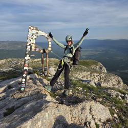
It is the longest, most difficult and highest via ferrata in Croatia, which leads to the highest Croatian mountain, Dinara or Sinjal. It is very demanding and due to its length and difficulty it requires good physical fitness and strength in the hands. There is a bivouac box on the via ferrata for emergency overnight stays.
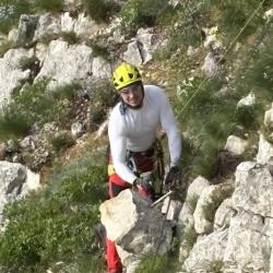
The climb contains all the elements that a first-class via ferrata should have - a distinctive airy ridge, steep vertical and attractive rocks that are constantly changing. The via ferrata is well designed in terms of safety. On the way to the summit, you climb a narrow exposed ridge, crossing bridges, ridges and impressive towers that offer unforgettable views. The total length of the via ferrata is 1700 m. The height difference during the ascent is 730 m. The difficulties of the individual sections (B, C, C/D and D).
Arrival
Access by car is from the main road Knin - Sinj. If you are coming from Knin, turn left towards Podinarje just before the Kijev town sign. After the junction you should drive 560 m to the first intersection and turn right there. After the junction, follow the narrow paved road that passes the village of Cegovići (Trnovača) and leads to a fork in the road on the west side of the village, where the directions of cycle routes 403 and 413 are highlighted (signposts for the via ferrata are expected soon).
At this point the gravel path separates from the access path to the via ferrata on the left side. This point was chosen as the starting point for this hike. The length of this road approach is 3.6 km. To shorten the access route to the via ferrata, you can drive an off-road vehicle to the Bili cvitak shelter, thus shortening the route by 3.3 km. Not recommended for vehicles with low ground clearance.
Boarding
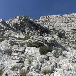
Climb the path up to the Bili cvitak shelter and then continue northeast to the entrance to the via ferrata.
Exit
I recommend climbing to the top of Dinara and then walking back on the hiking trail in a southeasterly direction until you reach the paved road and then on the gravel path back to the car.
Alternatively, you can descend directly to the car via the planned Ošljak via ferrata, which runs a little further north than the Via Ferrata Dinaridi.
Interesting facts
The longest, most difficult, most demanding and highest via ferrata in Croatia.
More information with a description of the trail in Croatian, topo photos and a GPX route can be found here: https://gorja.net/putopisi/377/ferrata-dinaridi-osljak/
(Multiple authors)


 © 2026 Ferrata Guide