Guter Zustand
Topo: Schaflucken-Steig (Topo)
Höhenunterschied: 700m
Parken: 47.8343°, 13.6891°
Klettersteig: 47.8276°, 13.6503°


Beschreibung
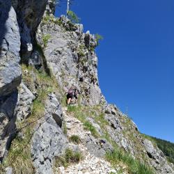
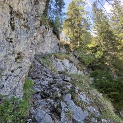
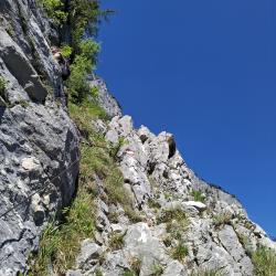
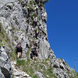
Der Klettersteig Schafluckensteig ist ein gesicherter Pfad, teilweise künstlich in den Fels geschlagen, der die Felswände oberhalb des Sees Hinterer Langbathsee am tiefsten Punkt des Tals überwindet und zum westlichen Teil des Höllengebirge-Plateaus führt, wo sich das Hochleckenhaus befindet. Die Route ist hauptsächlich für erfahrene Klettersteiggeher geeignet.
Anfahrt
Zum Vorderen Langbathsee.
Zustieg
Route 828 - Hinterer Langbathsee, 732 m - Klettersteig Schafluckensteig - bei 1430 m Wegweiser rechts "Brunnkogel" - Brunnkogel, 1708 m.
Abstieg
Auf dem gleichen Weg zurück.
Wissenwertes
(Mehrere Autoren)


 © 2026 Ferrata Guide