Guter Zustand
Höhenunterschied: 400m
Parken: 47.8729°, 13.8152°
Klettersteig: 47.8589°, 13.8156°


Beschreibung
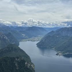
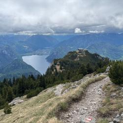
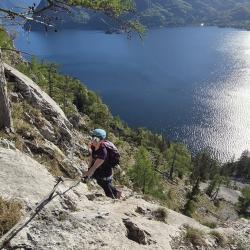
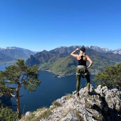
Ein Schöner und nicht zu ausgesetzter Klettersteig mit maximalem Schwierigkeitsgrad B, von dem man Ausblicke auf den Traunsee und Dachstein genießen kann. Kombinierbar mit Klettersteig Hans Hernler Steig.
Anfahrt
Linz (A1) - Ausfahrt Regau - Gmunden (B145) - über die Innenstadt im Osten. Am Ende der Straße gibt es einen Parkplatz und Zugang zum See mit Strand.
Zustieg
Vom Parkplatz südwärts am See vorbei durch 2 in den Fels gehauene Tunnel. Der Klettersteig beginnt auf der linken Seite am Ende des 2. Tunnels.
Abstieg
Es besteht die Möglichkeit, den Hans-Hernler-Steig zu nutzen (vom Traunstein Haus zur Gmundnerhütte und dann den Klettersteig hinunter – ACHTUNG, Sie müssen den rechten Steig nehmen, der andere hat den Schwierigkeitsgrad D).
Wissenwertes
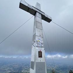
Auf dem Weg nach oben geht es durch ein interessantes Felsfenster, in dem ein Geocache versteckt ist.
(Mehrere Autoren)


 © 2026 Ferrata Guide